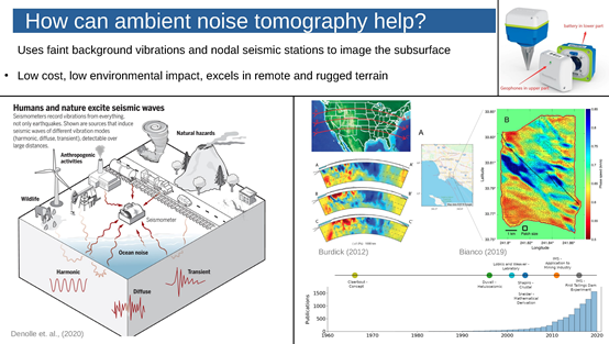

The Institute of Mine Seismology (IMS), a globally esteemed research institution specializing in mine seismology and equipped with state-of-the-art passive-source seismic data tomography processing technology, conducted an extensive one-month research project on the Tamar Fault in Tasmania, Australia.
The principal aim of this research initiative was to attain higher-resolution imaging of anomalies pinpointed in a low-resolution exploration survey conducted in 2013, with the overarching objective of advancing the development and utilization of geothermal and mineral resources within the island of Tasmania.

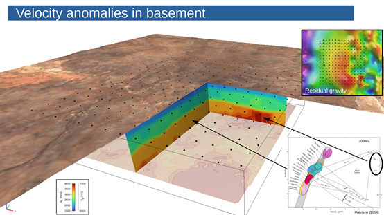
IMS successfully acquired high-resolution seismic data through Dense Array Measurement using the SmartSolo IGU-16HR data acquisition systems. The anomalies identified in the processing results closely mirrored those observed in the antecedent dataset. The ensuing results offered a more lucid representation of the depth and extent of the Tama Fault Zone. Employing exacting data processing methodologies, IMS meticulously fashioned a 3D subsurface velocity structure for the surveyed area, affording a heightened precision in localizing velocity anomalies near the fault zone, thus surpassing initial expectations.
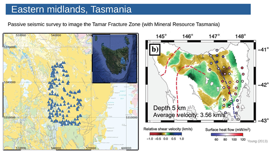
Situated in the southern expanse of Australia, Tasmania constitutes the smallest island state among the six states, encompassing more than 300 small islands. Renowned as the "end of the world," Tasmania is characterized by rolling hills, valleys, plateaus, volcanoes, and steep coasts.

A total of 144 SmartSolo Scientific IGU-16HR nodal seismic data acquisition systems were meticulously deployed near the Tamar Fault, as planned, to amass background noise data over one month.
*Graphics from IMS-The Role of Passive Seismic Imaging in Mineral Exploration
 After retrieving the equipment, IMS obtained high-resolution seismic data, and the anomalies identified in the processing results were consistent with the previous data set.
*Graphics from IMS-The Role of Passive Seismic Imaging in Mineral Exploration
The resultant depiction of the depth and range of the Tamar Fault Zone was more clearly articulated in the new findings. Through meticulous data processing, IMS successfully delineated the 3D underground velocity structure of the measurement area, affording a heightened accuracy in locating the velocity anomaly area near the fault zone, thereby exceeding initial expectations.
The expansive survey area of this project, characterized by scattered deployment locations, complex geographical conditions, and challenging fieldwork, necessitated the utilization of the IGU-16 series node-type data collector. Renowned for its compact design, lightweight construction, user-friendly interface, and durable build, this equipment substantially optimized fieldwork operations. Upon the completion of one month of data collection, IMS successfully acquired seismic data from all node data collectors, achieving an impressive recovery rate of 100%. Once again, the high reliability of SmartSolo Scientific was fully acknowledged by users.